


Nature » Unanimated nature » Relief
Relief
The Beskid Niski Mts., being a crosswise topographic law in the Carpathians curve, form a number of ridges and isolated hills separated by the wide downlows, stream and river valleys. The protection of this characteristic landscape was one of the reasons for creating the Magura National Park.
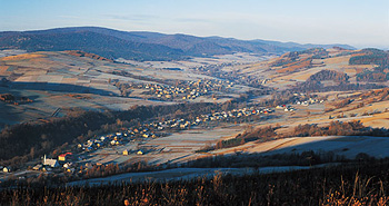
Wisloka river valley (phot. Slawomie Basista)
According to the Starkl’s relief types classification in the area of the MNP following relief types can be distinguished:
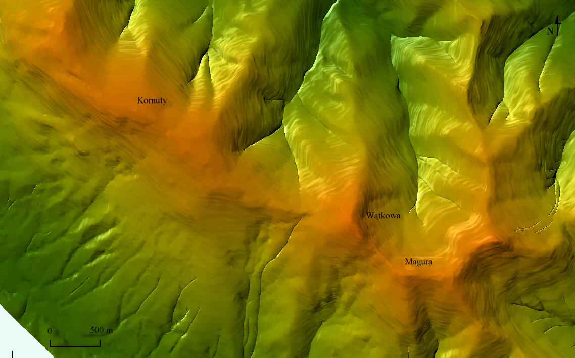
- Medium-high mountains with the altitude exceeding 800 m a.s.l., where the height difference is higher than 400 m. Those are summits of the Magura Watkowska range (Watkowa Mt., Magura Mt. and Kornuty Mt.)
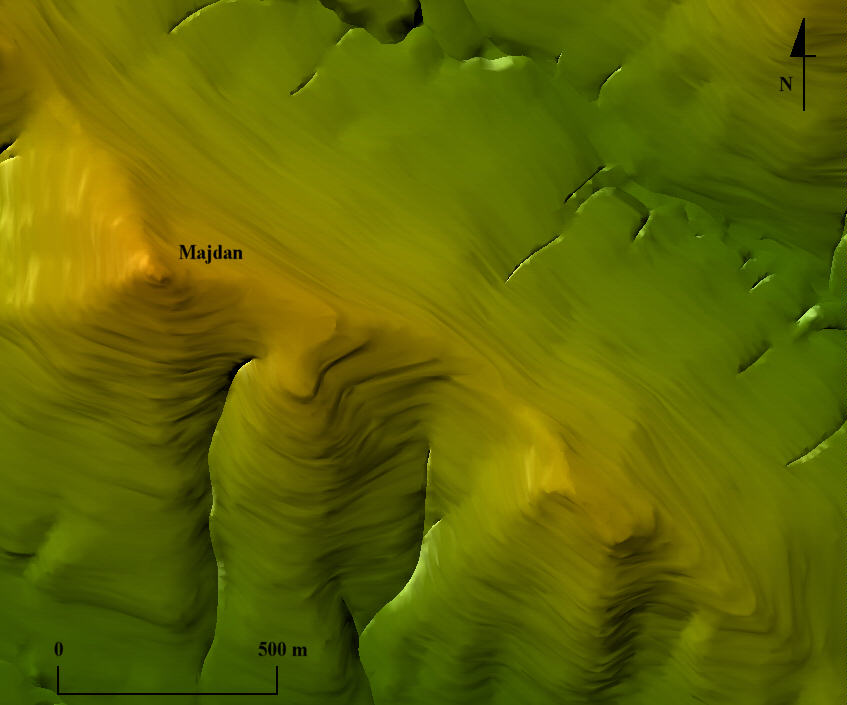
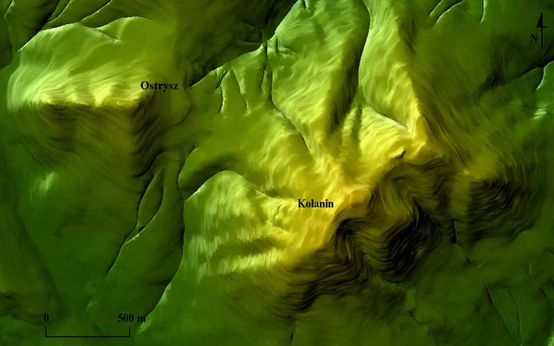
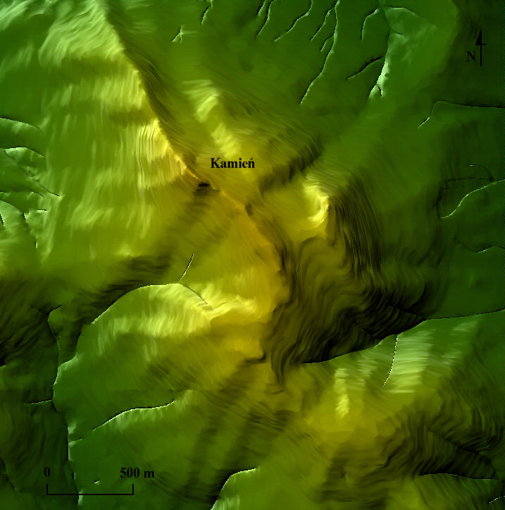
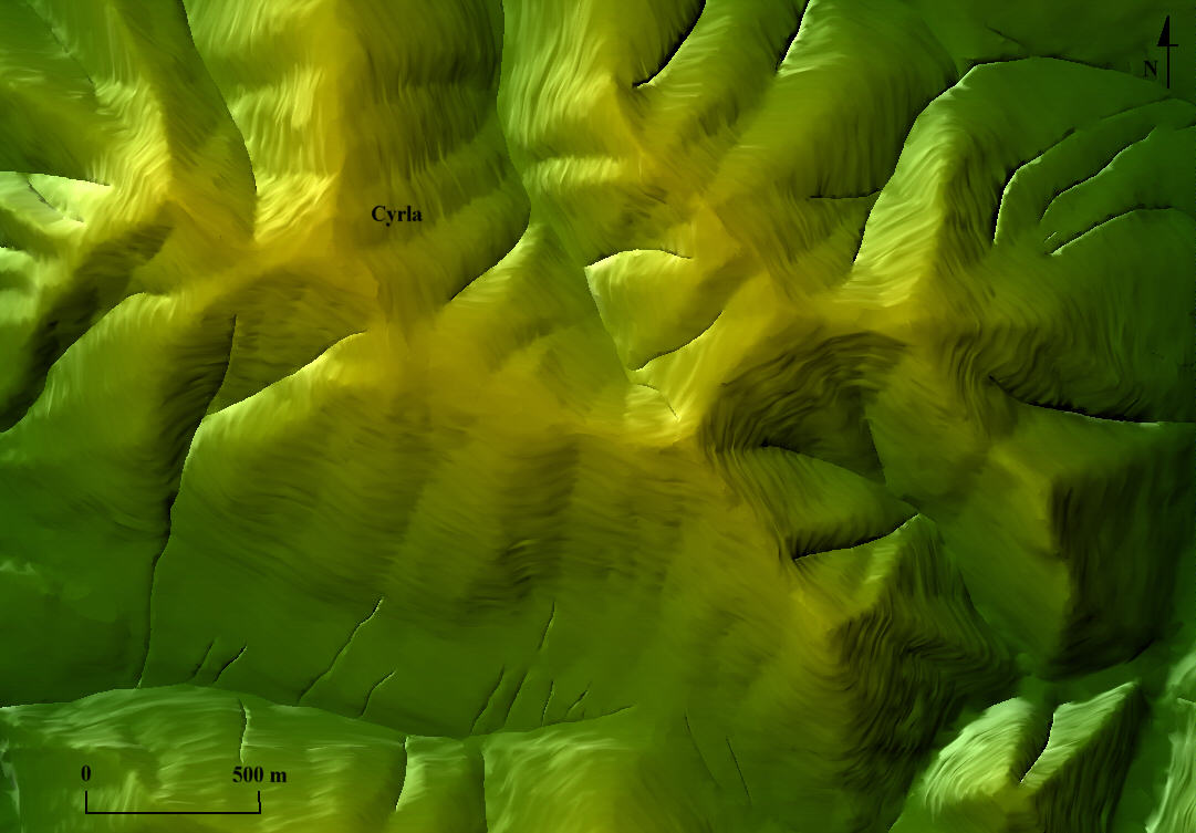
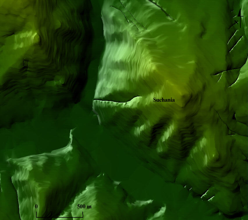
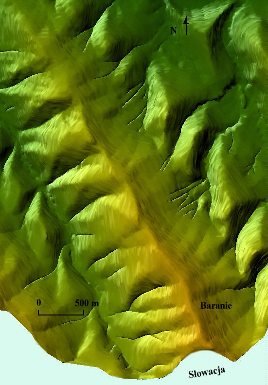
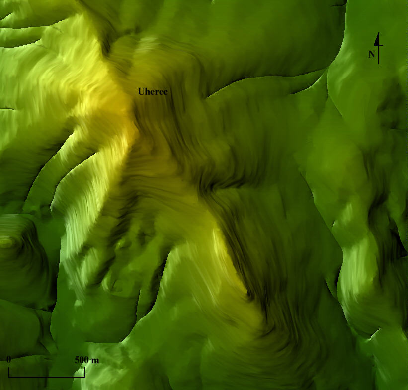
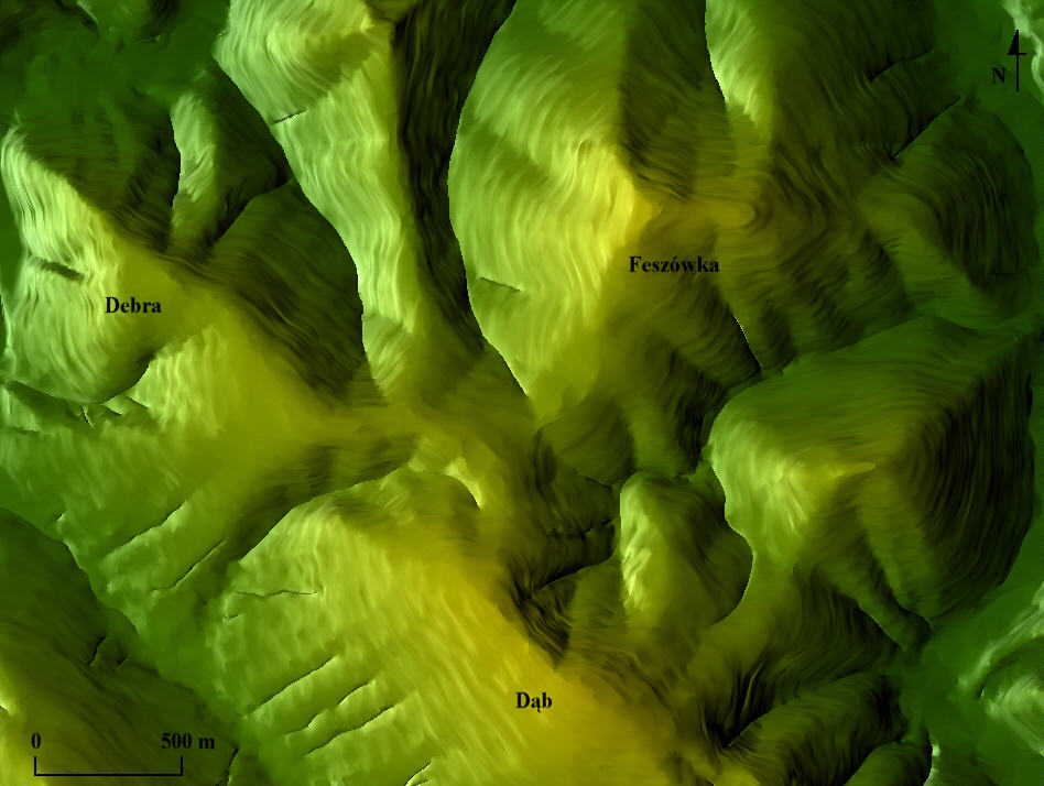
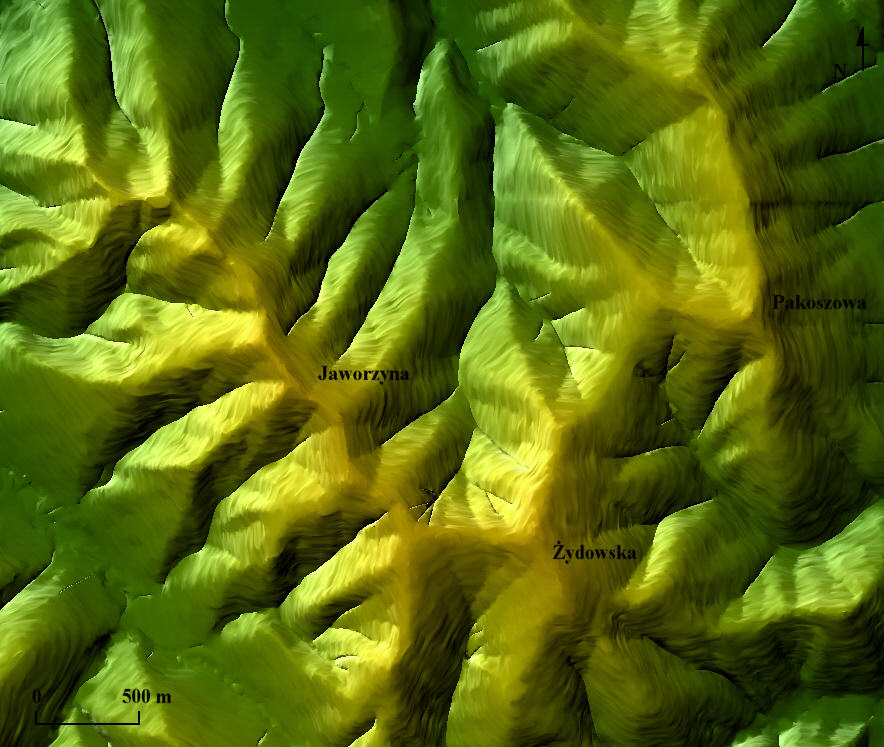
- Low mountains and high foothills with the absolute height set at above 500 m and small height differences (below 350 m), which, concerning their area, are dominant in the territory of the Park. Those are: Maly Ferdel Mt., Ferdel Mt., Majdan Mt., Ostrysz Mt., Kolanin Mt., Kamien Mt., Cyrla Mt., Suchania Mt., Czertez Mt., Czerszla Mt., Baranie Mt., Uherec Mt., Feszowka Mt., Dab Mt., Debra Mt., Zydowska Mt., Jaworzyna Mt. and Pakuszowa Mt.
- Medium-high and low foothills little and shallowly dismembered (height difference below 250 m) cover small fragments of the area near the villages Swiatkowa Wielka, Swiatkowa Mala and Kotan.
- Stream valleys – narrow in case of small watercourses (e.g. Swierzowka, Krempna, Barani streams), or wider and flat-bottomed (Wisloka, Wilsznia).
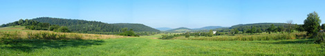
View onto Magura Watkowaska range (phot. Andrzej Czaderna)
The complexity of Park’s relief is fully showed on the hypsometric map of the Magura National Park (with the buffer zone). In the northern part of the Park the long Magura Watkowska ridge dominates and its Watkowa summit is the highest summit of the MNP. Below the Magura Watkowska ridge there is an isolated hummock of Mareszka Mt. The southern part of the Park, separated from the northern part by the Wisloka and Wilsznia valleys, is definitely lower. The mountain ridges lying in that part do not exceed the altitude of 750 m a.s.l. Their slopes cut through the deep valleys of the right-bank tributaries of the Wisloka river and Wilsznia stream, whose sources are located near the state frontier with Slovakia. The dominating part of the Park’s area (86 %) is between the altitude of 401 m a.s.l. and 650 m a.s.l., over 20 % of which is situated on the altitude of 501 – 550 m a.s.l. The lowest altitude found in the Park is 329 m a.s.l.
page 1 of 2
| next »